
價格:免費
更新日期:2017-08-12
檔案大小:20.7 MB
目前版本:5.5
版本需求:需要 iOS 9.0 或以上版本。與 iPhone、iPad 及 iPod touch 相容。
支援語言:法文, 義大利文, 英語, 西班牙文
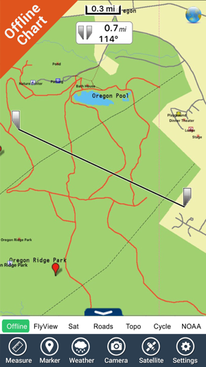
About Park:
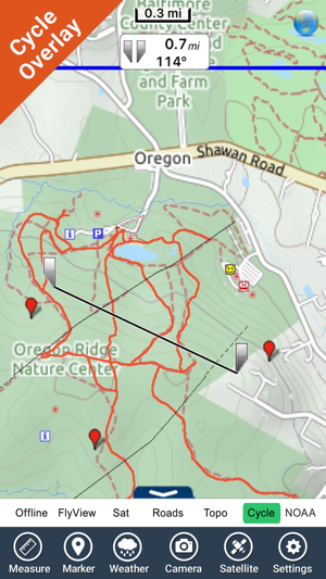
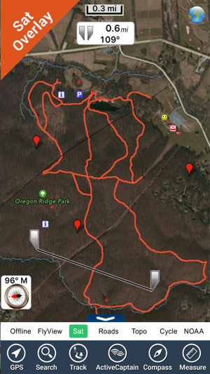
Oregon Ridge is the largest county run park in Baltimore. Oregon Ridge is set in the hills of northern Baltimore County. It has several miles of trails, a nature center, picnic areas, playgrounds and tennis courts.
There are several different trails running through Oregon Ridge Park. The trails are generally wide and fairly even with a few relatively steep spots. Most trails start at, or near, the nature center.
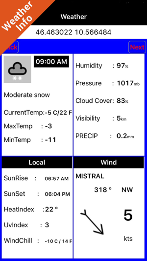
FlyToMap provides complete information for navigation:
Park map application is extremely advanced contains embedded electronic charts with all information collected from the National Park Service and local sources. The maps contain all multiple trails (Hiking, biking, Stairway trails, Bicycle trails, Equestrian trails etc.,) and Point of interests (POI) like Campgrounds, Eating places, Ranger Stations, Picnic areas, Boat/Canoe launching, Parking areas etc., .
Map Features:
GPS
Compass
Tracking Routes
Know Distance & Direction to a Marker
Know Speed towards Destination
Know Angle towards a Target
Offline Map
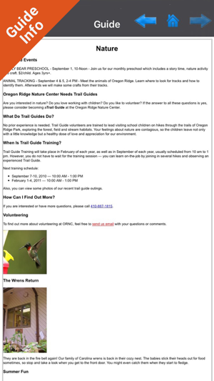
Travel Guide
Search places using Lat/Lon or names
…more
“Enjoy great journeys”
NOTE:
• Continued use of GPS running in the background can dramatically decrease battery life.
• Turn off GPS when not in use
支援平台:iPhone